This article synthesizes published sources listed below. Consult those sources for their evidence and scope.
A late-season storm crosses the hurricane threshold
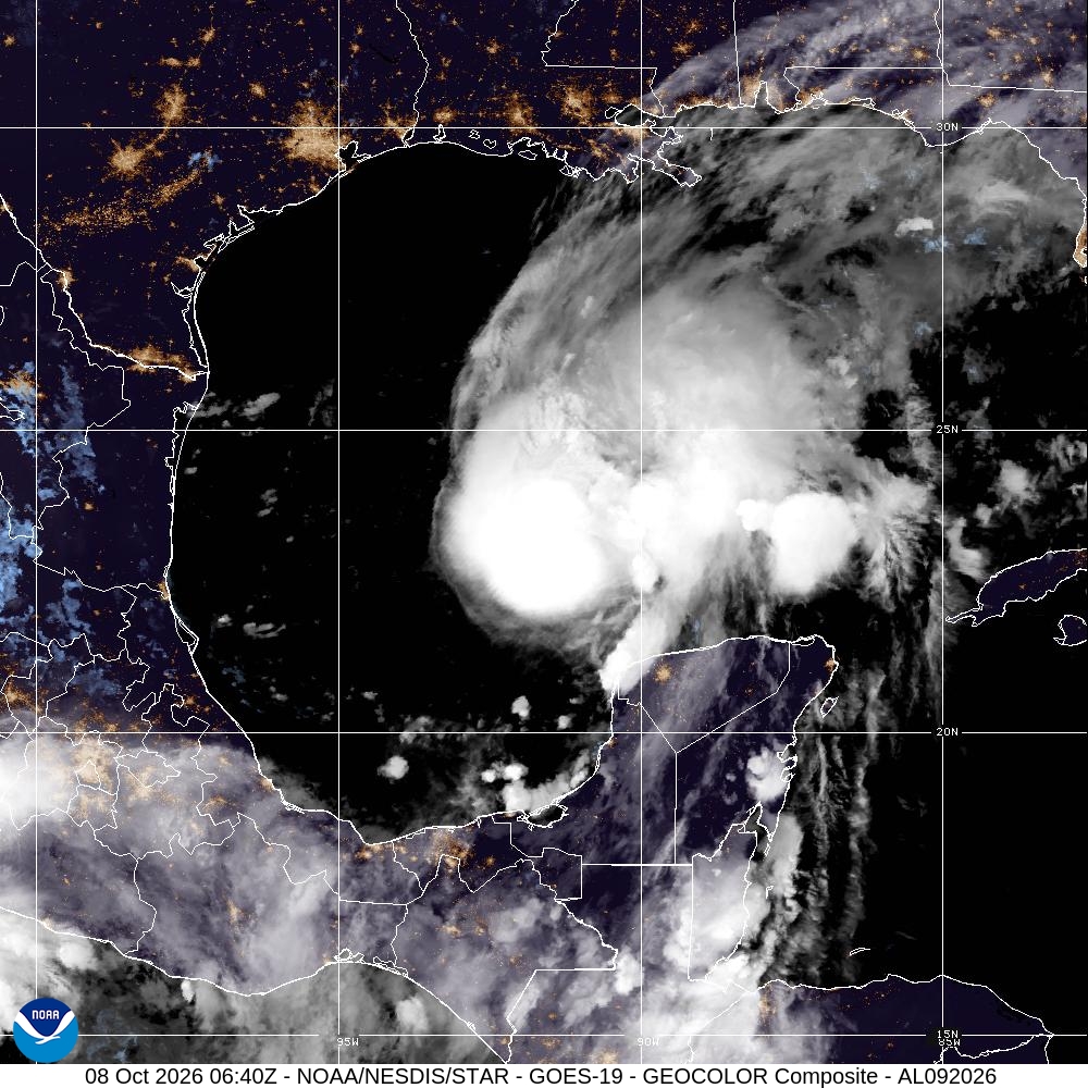
The National Hurricane Center said aircraft measurements showed Isaias had strengthened into a hurricane late on October 7, with maximum sustained winds of 75 mph and a minimum central pressure of 982 millibars. The centre was about 460 miles south-southwest of the mouth of the Mississippi River and moving east-northeast at 9 mph at the time of the update.
Isaias is the first Atlantic hurricane of the 2026 season, an unusually late milestone in a year when a strong El Niño suppressed many storms through increased wind shear. The season had produced eight earlier named storms, but none had reached hurricane strength.
Warnings stretch along the northern Gulf Coast
Forecasters expect additional strengthening before Isaias approaches the northern Gulf Coast on Friday night. Hurricane and storm-surge warnings cover parts of the coast, while heavy rainfall, damaging winds, coastal flooding and tornadoes are possible across sections of Louisiana, Mississippi, Alabama and Florida.
The precise landfall point and peak intensity can still change. Residents and emergency officials are relying on successive National Hurricane Center advisories because small shifts in the track could materially change where the strongest winds and highest surge occur.

Offshore production cuts add pressure to energy markets
The Marine Minerals Administration said operators had shut in about 25.08 percent of current Gulf oil production and 16.37 percent of current natural-gas production by October 7. Personnel had been evacuated from eight production platforms as companies prepared for deteriorating conditions.
Shell and Chevron curtailed work at multiple offshore facilities and moved workers ashore. Reuters reported that the storm is expected to pass through an area containing major offshore fields and onshore refineries, creating another supply risk while global oil prices are already elevated by conflict and shipping attacks in the Middle East.
The storm breaks an exceptional seasonal pattern
If the timing is confirmed in the final seasonal record, Isaias would tie the 1905 mark for the latest first Atlantic hurricane of a season, according to the Associated Press. Warm Gulf waters and a temporary reduction in hostile wind shear allowed the system to strengthen despite the wider El Niño pattern.
The unusual calendar does not reduce the immediate hazard. A quiet season can still produce a damaging storm, and Isaias now links a coastal emergency with energy-market exposure across a region central to US fuel production and refining.
Sources
4 references
- National Hurricane CenterHurricane Isaias tropical cyclone updateOfficial storm advisory · 2026-10-08
- ReutersIsaias intensifies into first Atlantic hurricane of 2026Independent reporting · 2026-10-08
- Marine Minerals AdministrationGulf oil and gas activity response to IsaiasOfficial production update · 2026-10-07
- Associated PressWeaker wind shear during El Niño plays a role in IsaiasIndependent weather reporting · 2026-10-07


